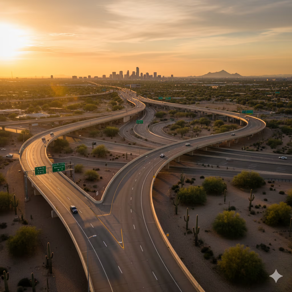
I‑10 carries the heaviest diesel traffic in the Valley. The guide above lists the exits and truck stops we have checked against ADOT and the travel-center chains, so you can give dispatch an exact location.
Same-Day Highway Service
Mobile Diesel Repair on I‑10 — Phoenix Metro
I-10 truck breakdown from Buckeye to Chandler? Verified exits, truck stops and what to tell dispatch. Typically 30–60 min, 7 AM–7 PM daily.
Licensed & insured · All of metro Phoenix · Upfront quote before work starts
Straight answers for I‑10
- How fast?
- Typically 30–60 minutes across the metro. Outlying areas can take longer; dispatch confirms your ETA when you call.
- Hours
- 7 AM–7 PM, every day including weekends and holidays. No overnight service.
- Cost
- You get an upfront quote for parts and labor before any work starts, so you approve the cost first.
- Payment
- Cash, major credit cards (Visa, Mastercard, Amex, Discover), fleet cards (Comdata, EFS), and invoicing for established commercial accounts.
Call dispatch: (602) 456-9071
Mobile diesel repair around I‑10
I-10 is the Valley's main east-west freight route. It runs from Buckeye (Miller Road, Exit 114) through Goodyear, Avondale and Tolleson, then through downtown Phoenix at the Stack (Exit 143) and southeast past Sky Harbor to the US 60 split (Exit 154) and Loop 202 near Chandler Boulevard. The west side has the heaviest cluster of truck stops. Pilot is at Exit 133, Love's at Exit 135, and Flying J and TA Phoenix share Exit 137. Downtown, hazmat loads can't use the Deck Park Tunnel and must take I-17 around it. The Loop 101/I-10 interchange is under construction through about 2029, with a 55 mph work zone on eastbound I-10 between 99th and 75th avenues through December 31. Summer heat is severe: Sky Harbor logged 37 days of 110 degrees or more in 2025. AZ Mobile Diesel Repair sends service trucks along the I-10 corridor from 7 AM to 7 PM daily. Response is typically 30–60 minutes across the Phoenix metro.
Freeways and exits
- West of downtown Phoenix, ADOT refers to I-10 as the Papago Freeway.
- Through the West Valley, ADOT's exit list places I-10 at Miller Road (Exit 114) in Buckeye, Litchfield Road (Exit 128) in Goodyear, 115th Avenue (Exit 131) in Avondale and 91st Avenue (Exit 134) in Tolleson before it reaches Phoenix.
- Major freeway-to-freeway junctions on I-10 in the metro are Loop 303 (Exit 124), Loop 101 (at Exit 133), I-17 at the Stack (Exit 143), SR 51 and Loop 202 Red Mountain (Exit 147), the south end of I-17 at the Split (Exit 150A), SR 143 (Exit 153) and US 60 Superstition Freeway (Exit 154).
- ADOT's state-route traffic list shows Loop 101 tying into I-10 at Exit 133.
- The Loop 202 South Mountain Freeway runs about 22 miles from I-10 Exit 138 on the west side (near 59th Avenue) around South Mountain to the four-level interchange with I-10 at Exit 161, between Chandler Boulevard and Wild Horse Pass Boulevard.
- According to the federal hazardous materials route registry, hazmat loads are restricted from I-10's Deck Park Tunnel in downtown Phoenix, between the 7th Street and 7th Avenue exits; I-17 is the posted alternate route for hazmat traffic.
- South of the metro, ADOT calls the 26-mile Wild Horse Pass Corridor (Loop 202 to SR 387 near Casa Grande) a crucial commuter and freight link, and is adding a lane each way to make I-10 three lanes each direction between Phoenix and Tucson.
| Freeway | Exit | Crossroad |
|---|---|---|
| I-10 | 114 | Miller Road (Buckeye) |
| I-10 | 124 | Loop 303 / Cotton Lane |
| I-10 | 128 | Litchfield Road (Goodyear) |
| I-10 | 131 | 115th Avenue (Avondale) |
| I-10 | 133 | 99th Avenue / Loop 101 |
| I-10 | 134 | 91st Avenue (Tolleson) |
| I-10 | 135 | 83rd Avenue |
| I-10 | 136B | 75th Avenue |
| I-10 | 137 | 67th Avenue |
| I-10 | 138 | 59th Avenue |
| I-10 | 139 | 51st Avenue |
| I-10 | 143 | I-17 (the Stack) |
| I-10 | 147 | SR 51 / Loop 202 Red Mountain Freeway |
| I-10 | 149 | Buckeye Road |
| I-10 | 150A | 24th Street / south end of I-17 |
| I-10 | 153 | SR 143 / 48th Street |
| I-10 | 154 | US 60 (Superstition Freeway) |
| I-10 | 155 | Baseline Road |
| I-10 | 160 | Chandler Boulevard |
| I-10 | 162 | Maricopa Road / Wild Horse Pass Boulevard |
| I-10 | 164 | SR 347 / Queen Creek Road |
Truck stops and freight areas
Truck stops and travel centers
- Love's Travel Stop #280 1610 S Miller Rd, Buckeye, AZ 85326 · I-10 Exit 114
- Pilot Travel Center #459 900 N 99th Ave, Avondale, AZ 85323 · I-10 Exit 133
- Love's Travel Stop #659 8313 Roosevelt St, Tolleson, AZ 85353 · I-10 Exit 135
- Flying J Travel Center #611 6700 W Latham St, Phoenix, AZ 85043 · I-10 Exit 137
- TA Phoenix 6741 W. Latham Street, Phoenix, AZ · I-10 Exit 137
- Love's Travel Stop #328 7001 W. Sundust Rd., Chandler, AZ 85226 · I-10 Exit 162
We can meet you at a truck stop lot if you can get there safely; tell dispatch which pump island or parking row you're in.
Warehouse, industrial and freight areas
- Tolleson, just south of I-10 at the Loop 101 interchange, describes itself as a distribution hub for Southwestern markets; employers include PepsiCo, Sunland Beef, Kroger, Albertsons, Home Depot, Staples and Sysco, and Union Pacific rail serves industrial sites there.
- The west-side cluster of truck stops sits between the 83rd and 67th Avenue exits: Love's #659 at Exit 135 and both Flying J #611 and TA Phoenix at Exit 137. TA Phoenix opened in January 2024 with a four-bay truck service center.
- PV|303, the large industrial park where Loop 303 meets I-10 in Goodyear, is reported as planned for more than 20 million square feet at buildout, with occupants including Boeing/XPO, HD Supply, Sub-Zero, Daimler and Fairlife.
- ADOT's 2024 counts show heavy truck volume on the west side: between the 67th and 59th Avenue exits, I-10 carried about 252,741 vehicles a day, including 15,249 combination trucks.
Ports of entry and inspection sites
- ADOT has no commercial port of entry on I-10 inside the Phoenix metro; its I-10 ports are at Ehrenberg (milepost 3.8, near California) and San Simon (milepost 383.3, near New Mexico).
What local conditions do to trucks here
- ADOT began rebuilding parts of the Loop 101/I-10 system interchange in mid-May 2026 on a roughly three-year schedule. Eastbound I-10 between 99th and 75th avenues has 11-foot lanes and a 55 mph limit through December 31.
- The I-10 Broadway Curve project, 11 miles between Loop 202 (Santan/South Mountain) and the I-17 Split, finished in spring 2025. It added collector-distributor roads between Baseline Road and 40th Street that separate through traffic from local exits.
- ADOT is studying I-10 from the Deck Park Tunnel to the I-10/I-17 Split because it is heavily congested at rush hour; from 2016 through 2021 the corridor averaged more than five crashes a day, mostly rear-end and sideswipe.
- ADOT scheduled construction on the I-10/Jackrabbit Trail interchange in Buckeye to start in August 2026 and run about two years, with overnight and weekend I-10 closures and ramp closures of about 45 days.
- South toward Casa Grande, I-10 Wild Horse Pass Corridor work is under way: new Gila River bridges and a 10-mile traffic shift between SR 387 and Gas Line Road. ADOT expects the whole project done by late 2029.
- Phoenix Sky Harbor recorded 122 days at or above 100 degrees and 37 days at or above 110 degrees in 2025, with a high of 118.
- For monsoon dust storms, ADOT's Pull Aside, Stay Alive advice is to pull completely off the pavement (not onto the shoulder), set the brake, turn off all lights including flashers and keep your seatbelt on until it passes.
Typical roadside calls
- Overheated on the westbound shoulder near the 67th Avenue exit, with Flying J and TA Phoenix at Exit 137 as the nearest place to get off the freeway.
- Air leak or brake problem in the Loop 101/I-10 work zone, where eastbound lanes are narrowed to 11 feet and speed is reduced to 55 mph.
- Hazmat load that has to get around the Deck Park Tunnel on I-17 and breaks down near the Stack or the Split.
- Coolant or belt failure in afternoon heat in slow traffic on the Broadway Curve between the US 60 split and Baseline Road.
- Tire or electrical problem in the SR 387 to Gas Line Road work zone south of the metro, where traffic has been shifted to the outer lanes.
Calling from I‑10? Tell dispatch this
- Your direction (eastbound or westbound) and the last exit you passed. For example: 83rd Avenue is Exit 135 and 67th Avenue is Exit 137.
- If you're near a truck stop, name it: Pilot #459 at Exit 133, Love's #659 at Exit 135, Flying J #611 or TA Phoenix at Exit 137, Love's #280 at Exit 114 in Buckeye, or Love's #328 at Exit 162 on the southeast side.
- Downtown, say whether you're west of the Stack (Exit 143), inside the Deck Park Tunnel area, or near the SR 51/Loop 202 junction (Exit 147).
- On the southeast side, say whether you're on the Broadway Curve main lanes or a collector-distributor road between Baseline Road and 40th Street.
- Tell dispatch if you're hauling placarded hazmat, because it affects the route around the Deck Park Tunnel.
Sources we checked for this page (2026-09-28)
Service areas along this route
Tap a city for its exits, truck stops and local map
Frequently Asked Questions
Frequently Asked Questions
Which I-10 exits have truck stops on the west side of Phoenix?
Which I-10 exits have truck stops on the west side of Phoenix?
Official locators list Pilot Travel Center #459 at Exit 133 (900 N 99th Ave, Avondale), Love's #659 at Exit 135 (8313 Roosevelt St, Tolleson), and both Flying J #611 (6700 W Latham St) and TA Phoenix (6741 W. Latham Street) at Exit 137. Farther west, Love's #280 is at Exit 114 in Buckeye. On the southeast side, Love's #328 is at Exit 162 (7001 W. Sundust Rd., Chandler).
Can a hazmat load go through downtown Phoenix on I-10?
Can a hazmat load go through downtown Phoenix on I-10?
No. The federal hazmat route registry restricts hazardous materials in I-10's Deck Park Tunnel between the 7th Street and 7th Avenue exits, and I-17 is the posted alternate. If you break down while detouring, tell dispatch you're placarded and whether you're on I-17 or I-10.
Where is the Stack, and where is the Split?
Where is the Stack, and where is the Split?
The Stack is where I-10 meets I-17 west of downtown, at I-10 Exit 143. The Split is where I-17 ends at I-10 near 24th Street (Exit 150A), just west of Sky Harbor. Telling dispatch which one you're near, plus your direction, narrows your location quickly.
What hours does roadside service run on I-10?
What hours does roadside service run on I-10?
Service runs 7 AM to 7 PM, seven days a week. Response is typically 30–60 minutes across the Phoenix metro. Be ready with your direction, the nearest exit number and what the truck is doing, such as overheating, an air leak or a no-start.
Repairs we do on the shoulder
Dispatch · 7 AM–7 PM daily
AZ Mobile Diesel Repair
Serving Phoenix, AZ • I-10, I-17, Loop 202. Typically 30–60 min across the metro.
- I-10